Wow, another stormy day on the Highveld. I have to admit though, the severity of this storm was totally unexpected. At first glance it didn't seem like it was going be such a big storm. Even with the mammatus at the beginning I didn't think it would be as bad as it got. After all, the presence of mammatus isn't always an indication of severe weather. But it seems this time it was. In a way, this storm was actually worse than Monday's storm, despite that storm's fearsome appearance.
 |
| A spectacular display of mammatus ahead of the storm over Moreleta Park in Pretoria |
After the passage of the mammatus, it became quite clear that this wasn't going to be just an ordinary thunderstorm that would pass with just a bit of rain and some lightning and thunder as I originally thought. Almost immediately the wind picked up, a lot and with it, the dust really started to kick up. The clouds, as in the image below, really took on a menacing appearance that said this was going to be one really bad storm. And boy what a really bad storm it turned out to be.http://www.youtube.com/watch?v=cgkpza9Kqew . This video by Danie Bester shows just how bad the storm got. It was shot in the Silver Oaks area of Pretoria East along the Hans Strydom (Solomon Mahlangu) Drive. After the dust had gone, it rained for the next hour or so. It is interesting to note that much of the Johannesburg area got very little or no rain at all that day, while in Pretoria it rained for in some cases more than hour.
 |
| These clouds were swirling and twisting very turbulently, which explains the windy conditions that came this storm |
I would also seem that mammatus was the common feature that constantly kept showing up on this day. Mammatus was also observed in parts of Johannesburg as the storm passed over the city. So here is another question. What is mammatus and how does it form? http://ww2010.atmos.uiuc.edu/%28Gh%29/guides/mtr/cld/cldtyp/oth/mm.rxml. Mammatus are pouch-like cloud structures that most commonly form underneath the anvils of thunderstorms (not necessarily always severe thunderstorms). They can form both at the front and rear of the thunderstorms. The term mammatus is derived from the Latin word mama which literally means breasts.
 |
| Mammatus over Fort Worth, Texas on May 20 2013 (Courtesy of Sundog Art Photography) |
 |
| This is regarded as hands down one of the best mammatus photographs of all time. It was shot by John C. Olsen in Hastings, Nebraska in 2004. (Courtesy of John C. Olsen) |
There are a number of theories as to how mammatus forms. Mammatus is in fact one of the few cloud types that form when air sinks instead of when it rises, as is the case with most cloud types.http://www.weather.com/blog/weather/8_9259.html, http://eo.ucar.edu/webweather/cloudpic9.html. These two links provide some brief but valuable information into how mammatus clouds form and why they are such a fascination cloud type. Unlike tornadoes, mammatus can occur anywhere where thunderstorms occur, although it does tend to form more in places that have conditions that frequently favour the development of severe thunderstorms, like America's Tornado Alley and the Highveld region of South Africa.
While mammatus may not always indicate severe weather, it turbulent and ominous appearance does indicate huge amounts of turbulence in the atmosphere. For this reason, pilots are strongly discouraged to fly when mammatus is visible in the clouds, even if they are not cumulonimbus clouds.
 |
| Dark ominous clouds moving over Moreleta Park in Pretoria on 10 October 2013. Notice the dust in the distance, indicating the strong outflow that brought the strong winds that caused chaos throughout the city. |
Mammatus clouds are beautiful to watch and they have a certain allure about them, especially when combined with other beautiful weather features like sunsets, as the image below shows. I shot this picture after the storm on Thursday had passed. I was quite impressed by the beautiful colours of the sunset below and contrast of the dark ominous mammatus above it. It was an amazing juxtaposition of two opposing forces of nature that I just had to capture.
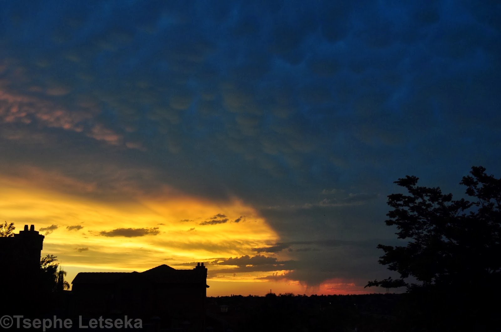 |
| Sunset in Moreleta Park following the 10 October 2013 storm with a spectacular mammatus display just above |
3 comments:
Awesome pics! I have learnt so much already - never knew about mammatus clouds! Thanks for an informative blog!
I actually drove into and through this storm when it was still on the west rand, and it felt as if the wind would topple my Hyundai bakkie with overhead canopy! It was scary but amazing. I have always longed for a protective see-through dome under which I could experience such a storm first hand but in safety; maybe one day?
Thanks Teresa. It was quite an amazing storm indeed. The mammatus really made for an awesome visual spectacle.
Post a Comment